Hiking Liguria
(click on "Things to do" menu item to return to previous page)
If you mention that you've hiked in Liguria, everyone will say: Cinque Terre! This nice stretch of paths on the east side of Liguria, near La Spezia (2.5 hour drive from Bussana) is worthwile walking, but you likely will be joining busloads of other tourists who walk this path and all want to eat at the few restaurants and stop at the same sightseeing points. I had the pleasure of walking it with my parents, a guide, and a donkey in the 1960's and it was impressive. Every time I went again it became more touristy and the small towns along the route are now entirely focused on tourism.
What few people know is that in recent years many wonderful paths have been created along the Ligurian coast that are equally nice and very quiet, with similar breathtaking views. If you want to 'do' the Cinque Terre you'll need to be prepared for a full day touristy hike or opt to stay in a nearby tourist hotel. If you hike the other coastal paths you can select a hike that best fits your schedule and physical condition.
The easiest walking (or biking) activity is along the pista ciclabile, but within less than one hour from Bussana you can also find Alpine paths along the French-Italian border at altitude 2100m (8000ft) that are only for experienced hikers.
A great place to take a look at hiking trails is the Verdeazzurro website. It is in Italian but is more or less self-explanatory.
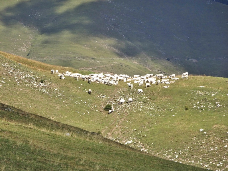
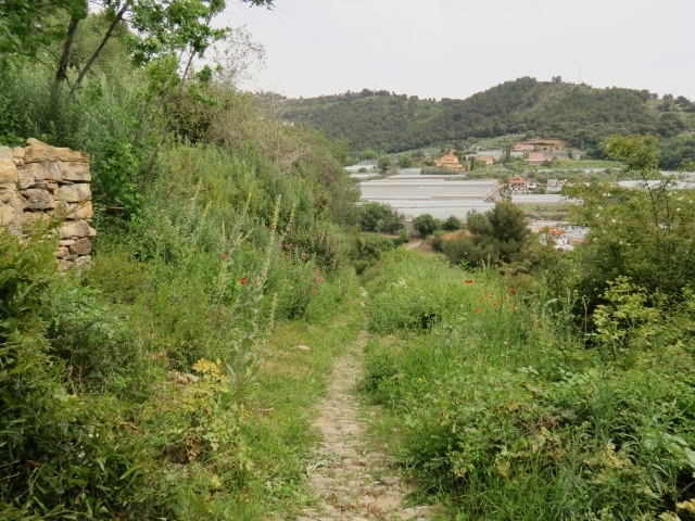
1.Bussana Vecchia (180 m alt) Mulatteria to beach
Click on the image of the Mulatteria for a larger size.
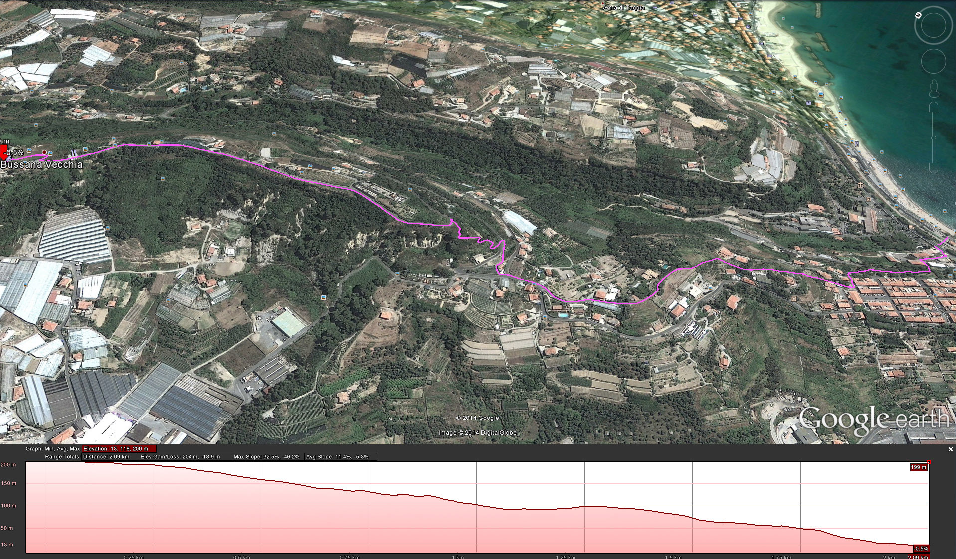
This donkey path has signposts and the well-known white/red paint marks along the route and takes you down to Bussana Nuova and the beach (or the supermarket) in about 30 minutes. If you find the trail too strenous you can also follow the paved road. This will take 5 minutes more time.
2. Pista ciclabile (see bike section)
3. Bussana Vecchia backdoor paths to Taggia and to Sanremo
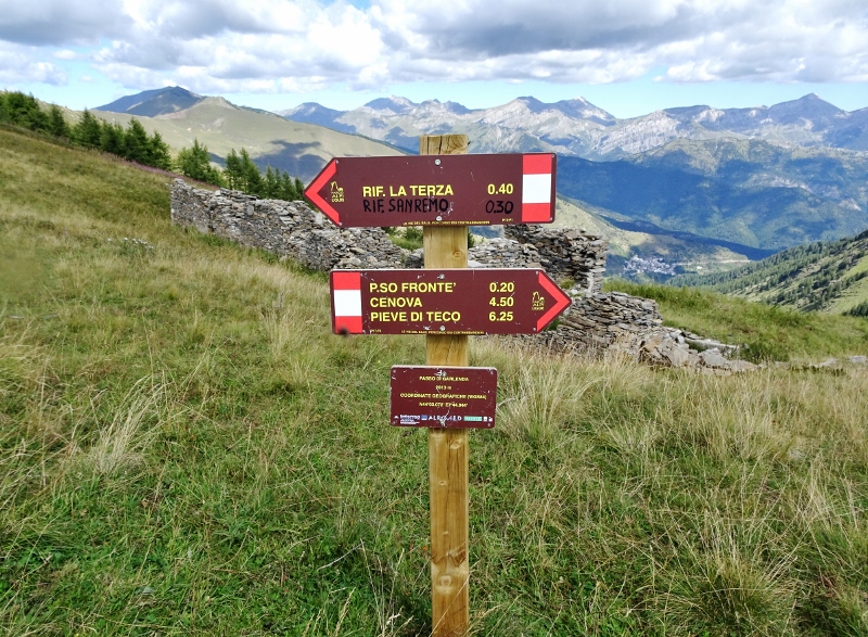
The Roman footpath to Sanremo actually starts at the bottom of our stairs! Simply walk down under the arch and you'll end up on a path that takes you down the Armea Valley. Follow the signs to Sanremo. It is part of a set of paths all along the Ligurian coast, called Sentieri Costale.
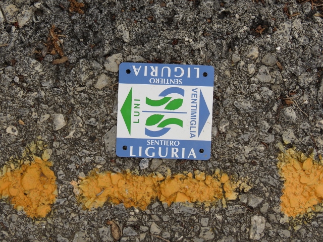
These paths with total length of 650 km (between the towns of Ventimiglia and Luni) are marked by the small blue/green signs as shown above and yellow arrows for direction. At least once a year a group of volunteers clears out these paths and repaints the directions. An article (in italian) can be found on the Corriere della Sera newspaper travel website.
Lucca, one of the owners of the Piazzetta Golosa, is a very active hiker and member of the Ligurian hiking association. He sets out paths and maintains them in our area, so ask him if you are looking for a great hiking trail.
You will find all hiking paths along the coast (including Cinque Terre) in the TappeSentieroLiguria pdf document.
4. Alta Via Hikes
The western part of Liguria directly connects into the alpine area. Within one hour drive you can find many hiking paths at considerable altitude and with spectacular views.
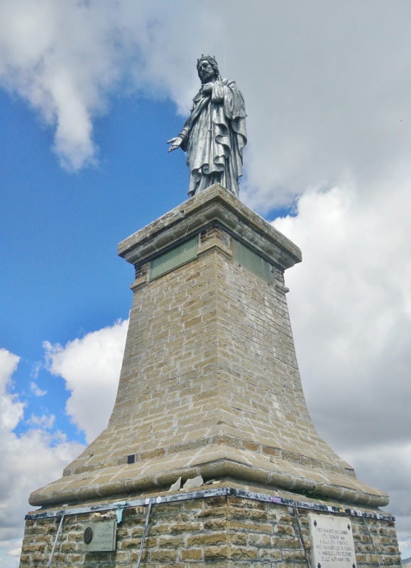
Take a look at the Alta Via section of the Verdeazzurro website for details. These 'old roads' have been built for defence purposes in the 19th and early 20th century. In the past years we've hiked several of these paths (with our young son) starting at the rifugio Allavena at the Lago di Tenardo (e.g. Strada Alpinisti and Balcone Marta), or at the hamlet of Verdeggia (for hiking the Monte Saccarello and Redentore statue).
See my 360 image below near the Balcone di Marta on the Alta Via.
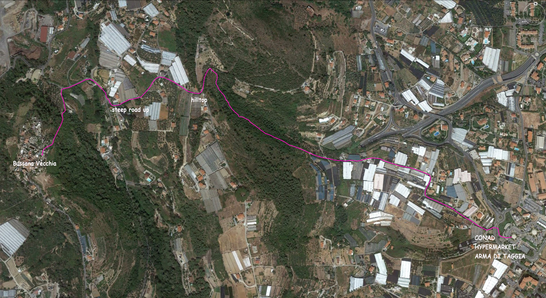
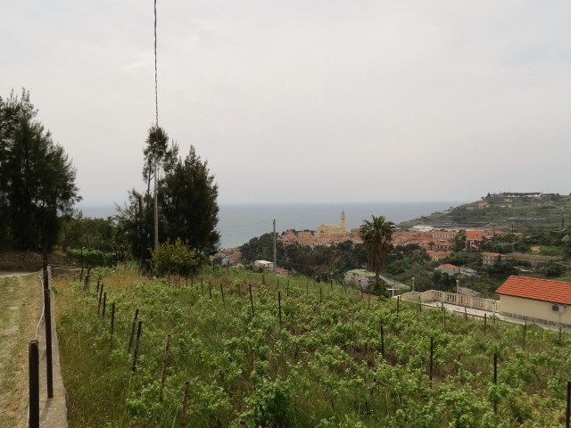
5. Donkey path to Arma di Taggia
As alternative for the donkey path to Bussana beach and Arma, you can take the 2.5 km path starting at the back of Bussana Vecchia (small chuch and Roanld's la Barca) down to the road and take 2nd road to the left (near a garbage collection point) up the hill opposite Bussana. This steep road with old greenhouses offers nice views of Bussana Vecchia. At the top of the hill follow the overgrown road down for about 100 meter and take sharp right onto a
footpath, which will lead you to the CONAD hypermaket and other shops in Arma di Taggia. From the CONAD you can follow several streets to the center of Arma and the beaches. To return, you can take the donkey path from Bussana beach via Bussana Nuova back home.
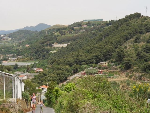
6. Due Colli hike
A short (1.5 - 2 hr) and easy hike with nice views of Bussana Vecchia, Taggia, Arma di Taggia and the coast line.
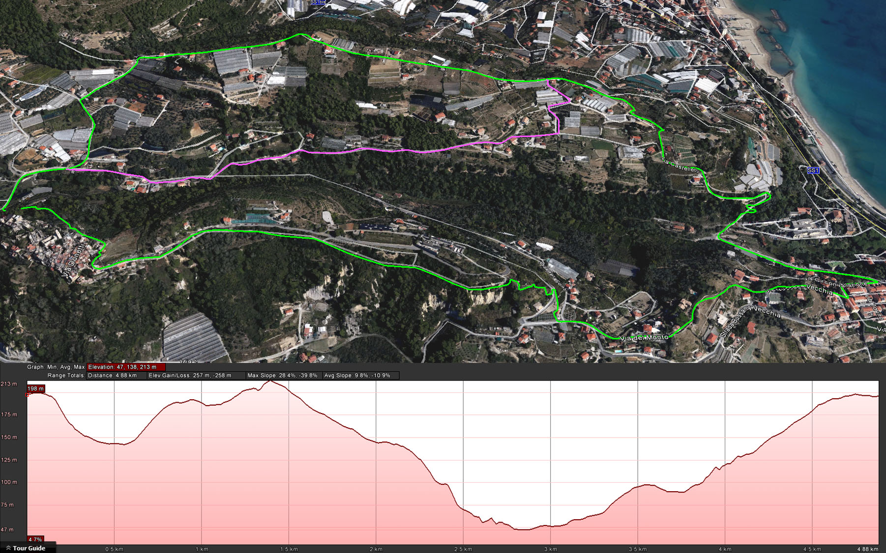
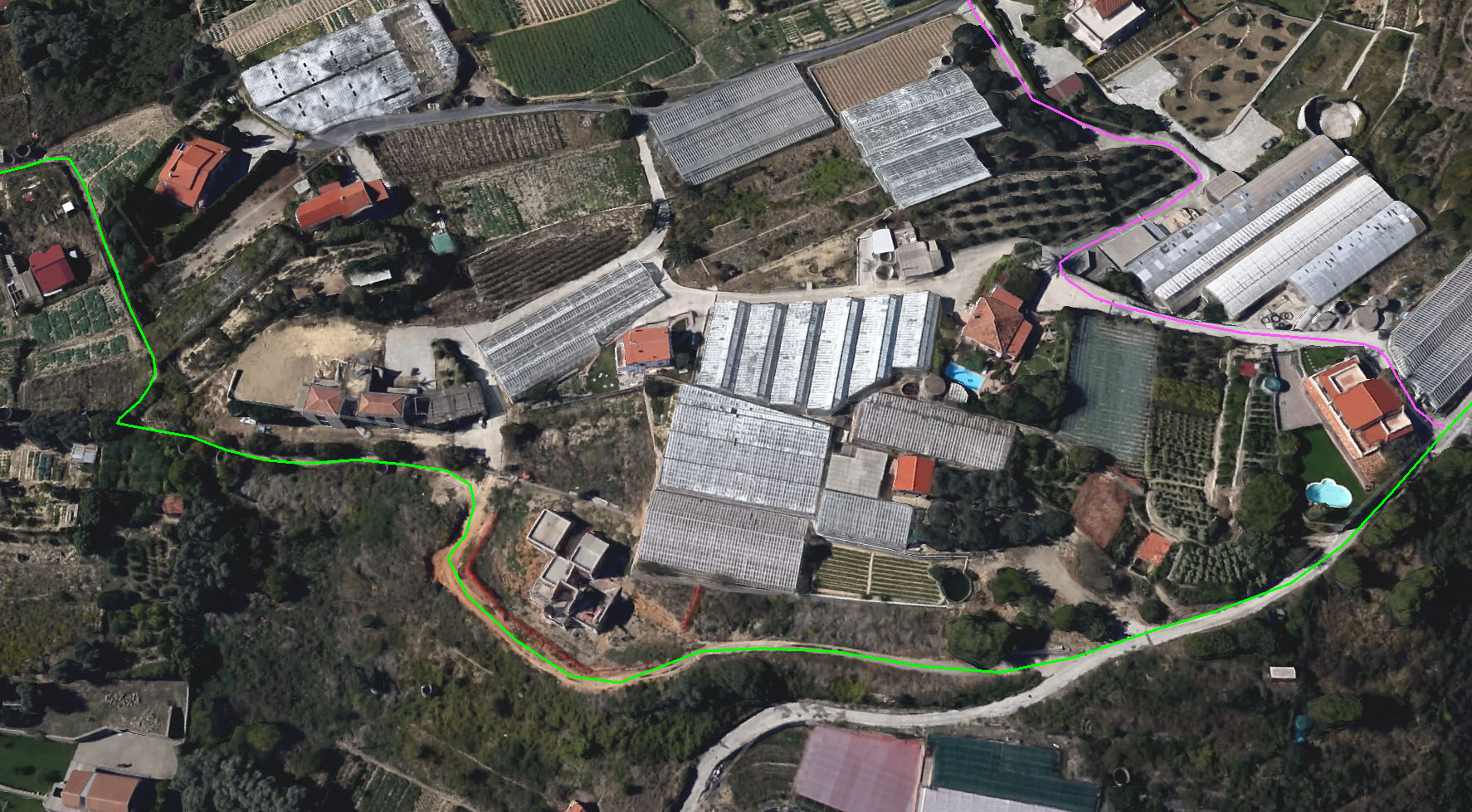
Take the 'backdoor' path from the small Bussana Vecchia church down towards Taggia, turn right where it meets the paved road (there's a bus stop), follow road (and Sentiero Costale) and take left onto the Due Colli road to the top of the small hill.
At the top, go right (the Sentiero goes left towards Taggia) and follow the paved road with great views of Taggia and Arma. You'll pass a old fortress. Leave the paved road some 300 m further onto a dirt road and pass a house skeleton (under construction for many years) until you see a large water tank. Take a short right there and follow the ditch next to the farmland about 50m and go left to get back to a farm road. Follow this road down, and up, and you'll arrive at Bussana Nuova. From there you follow the Mulatteria back to Bussana Vecchia.
To reduce the hike to under one hour you can take a shortcut (purple line) by taking a right turn (200m after the fortress), at the barrier of a new house. The barrier is to block access to other than local cars. You are permitted to go past the barrier on foot. Some 50 m further you can go right onto a 'private' paved road to go down to a small road leading you back into the valley. Alternatively you can follow the road to the left and exit the property via an opening near the entrance gate.
We've done this with our 5-year old and stopped for ice cream at Bussana Nuova. Some houses have dogs but these were all within fenced areas. There's a more detailed view of the dirt road and shortcut below. You'll get a larger version if you click on the image.
To be done:
- Bussana to Beuzi and Taggia
- Bussana (180m) to Beuzi and Ceriana (6 hr hike)
- Rifugio Colle Melosa (1500m)- Balcone di Marta (1900 m)(4 hr hike)
- Rifugio Colle Melosa (1500 m)- Strada Alpinisti (2300 m)(6 hr strenous hike, not for people with fear of heights..)
- Verdeggia (1000m)- Monte Sacarello - Il Redentore (2100 m)(8 hr hike)